North Huish Church
Introduction
The photograph on this page of North Huish Church by Derek Harper as part of the Geograph project.
The Geograph project started in 2005 with the aim of publishing, organising and preserving representative images for every square kilometre of Great Britain, Ireland and the Isle of Man.

There are currently over 7.5m images from over 14,400 individuals and you can help contribute to the project by visiting https://www.geograph.org.uk
North Huish Church
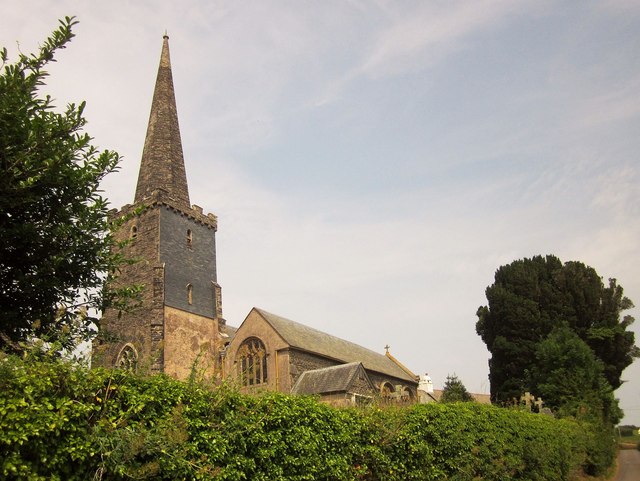
Image: © Derek Harper Taken: 24 Jul 2014
"The dedication to St Mary may not be authentic" http://list.english-heritage.org.uk/resultsingle.aspx?uid=1108208&searchtype=mapsearch (a very thorough description) . The grade I listed church is "largely early C14, probably with earlier fabric". This view, like Image, is from the lane from Rectory Cross.
Images are licensed for reuse under creativecommons.org/licenses/by-sa/2.0
Image Location
Latitude
50.394574
Longitude
-3.814555