
Custom House for ExCeL DLR station
Introduction
The photograph on this page of Custom House for ExCeL DLR station by Nigel Cox as part of the Geograph project.
The Geograph project started in 2005 with the aim of publishing, organising and preserving representative images for every square kilometre of Great Britain, Ireland and the Isle of Man.

There are currently over 7.5m images from over 14,400 individuals and you can help contribute to the project by visiting https://www.geograph.org.uk
Custom House for ExCeL DLR station
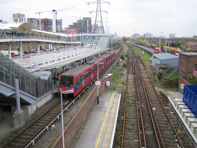
Image: © Nigel Cox Taken: 20 Apr 2007
On the left is the Custom House for ExCeL DLR Station with the ExCeL Exhibition Centre beyond. On the right is the now closed section of Network Rail's former North London Line, showing the platforms at the western end of Custom House station. Beyond that to the right is Victoria Dock Road with the two buses. DLR Unit No. 79 is about to leave with an eastbound train for Beckton. Despite the line having been closed since December 2006 the Network Rail signal at the end of the westbound platform is still lit and showing red. Note that the location of the DLR station on the Ordnance Survey 1:50,000 scale map shown with this image, as marked with a yellow circle, is grossly wrong by at least a hundred metres eastwards from its true location. The OS 1:25,000 scale mapping is better, although not perfect.
Images are licensed for reuse under creativecommons.org/licenses/by-sa/2.0
Image Location

Latitude
51.509543
Longitude
0.024631