Bolster Moor, Golcar (2)
Introduction
The photograph on this page of Bolster Moor, Golcar (2) by Humphrey Bolton as part of the Geograph project.
The Geograph project started in 2005 with the aim of publishing, organising and preserving representative images for every square kilometre of Great Britain, Ireland and the Isle of Man.

There are currently over 7.5m images from over 14,400 individuals and you can help contribute to the project by visiting https://www.geograph.org.uk
Bolster Moor, Golcar (2)
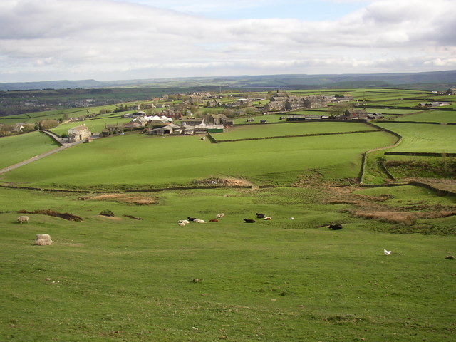
Image: © Humphrey Bolton Taken: 19 Apr 2007
This photograph shows how the ridge slopes from east (left) to west. A chapel at the extreme right is on the edge of the escarpment. Most of the hamlet of Bolster Moor can be seen, the houses being mostly strung out alongside a triangle of roads, with just a few short side streets. In the foreground, a free-range hen shares the field with cows and sheep.
Images are licensed for reuse under creativecommons.org/licenses/by-sa/2.0
Image Location


Leaflet Map data © OpenStreetMap
Latitude
53.637119
Longitude
-1.870501