Toll House
Introduction
The photograph on this page of Toll House by Anne Burgess as part of the Geograph project.
The Geograph project started in 2005 with the aim of publishing, organising and preserving representative images for every square kilometre of Great Britain, Ireland and the Isle of Man.

There are currently over 7.5m images from over 14,400 individuals and you can help contribute to the project by visiting https://www.geograph.org.uk
Toll House
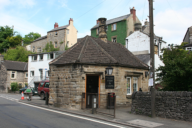
Image: © Anne Burgess Taken: 25 Jun 2014
This little sandstone building is instantly recognisable as a toll house because of the windows placed at 45º to the road, so that the tollkeeper could easily see approaching traffic. It is now a fish and chip shop.
Images are licensed for reuse under creativecommons.org/licenses/by-sa/2.0
Image Location
Latitude
53.275899
Longitude
-1.656998