Drill Hall, Manse Brae
Introduction
The photograph on this page of Drill Hall, Manse Brae by Patrick Mackie as part of the Geograph project.
The Geograph project started in 2005 with the aim of publishing, organising and preserving representative images for every square kilometre of Great Britain, Ireland and the Isle of Man.

There are currently over 7.5m images from over 14,400 individuals and you can help contribute to the project by visiting https://www.geograph.org.uk
Drill Hall, Manse Brae
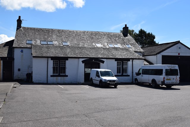
Image: © Patrick Mackie Taken: 10 Jul 2014
A drill hall is marked on the 2nd edition OS 1:2500 map (surveyed 1898). In 1914 it was the base for "E" Company, Argyll & Sutherland Highlanders. The hall survives within a Territorial Army Centre and is a slated stone-built hall with an aisle with porch facing the road. Information from HS/RCAHMS World War One Audit Project (GJB) 19 September 2013.
Images are licensed for reuse under creativecommons.org/licenses/by-sa/2.0
Image Location
Latitude
56.038701
Longitude
-5.431162