Stand United Reformed Church, Radcliffe
Introduction
The photograph on this page of Stand United Reformed Church, Radcliffe by David Dixon as part of the Geograph project.
The Geograph project started in 2005 with the aim of publishing, organising and preserving representative images for every square kilometre of Great Britain, Ireland and the Isle of Man.

There are currently over 7.5m images from over 14,400 individuals and you can help contribute to the project by visiting https://www.geograph.org.uk
Stand United Reformed Church, Radcliffe
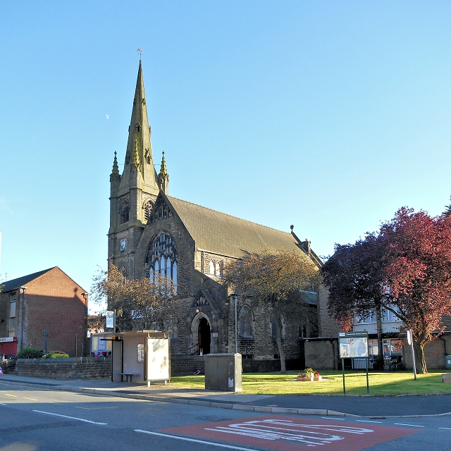
Image: © David Dixon Taken: 5 Jul 2014
The large United Reformed Church on Stand Lane was built in 1885 in the Chapelfield area of Radcliffe. It is a Grade II listed building (English Heritage Building ID: 471808 http://www.britishlistedbuildings.co.uk/en-471808-stand-united-reformed-church- British Listed Buildings).
Images are licensed for reuse under creativecommons.org/licenses/by-sa/2.0
Image Location
Latitude
53.551207
Longitude
-2.314356