Bench mark on Alder's Bridge, Fazakerley
Introduction
The photograph on this page of Bench mark on Alder's Bridge, Fazakerley by John S Turner as part of the Geograph project.
The Geograph project started in 2005 with the aim of publishing, organising and preserving representative images for every square kilometre of Great Britain, Ireland and the Isle of Man.

There are currently over 7.5m images from over 14,400 individuals and you can help contribute to the project by visiting https://www.geograph.org.uk
Bench mark on Alder's Bridge, Fazakerley
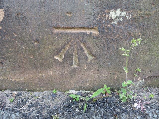
Image: © John S Turner Taken: 16 May 2014
Ordnance Survey bench mark near the south east corner of Alder's Bridge. Maps up to 1937 show a bench mark at the centre of the north parapet opposite, but that stonework is very weathered so I presume that mark has been lost to erosion.
Images are licensed for reuse under creativecommons.org/licenses/by-sa/2.0
Image Location
Latitude
53.472221
Longitude
-2.907504