Llangollen station
Introduction
The photograph on this page of Llangollen station by Flying Stag as part of the Geograph project.
The Geograph project started in 2005 with the aim of publishing, organising and preserving representative images for every square kilometre of Great Britain, Ireland and the Isle of Man.

There are currently over 7.5m images from over 14,400 individuals and you can help contribute to the project by visiting https://www.geograph.org.uk
Llangollen station
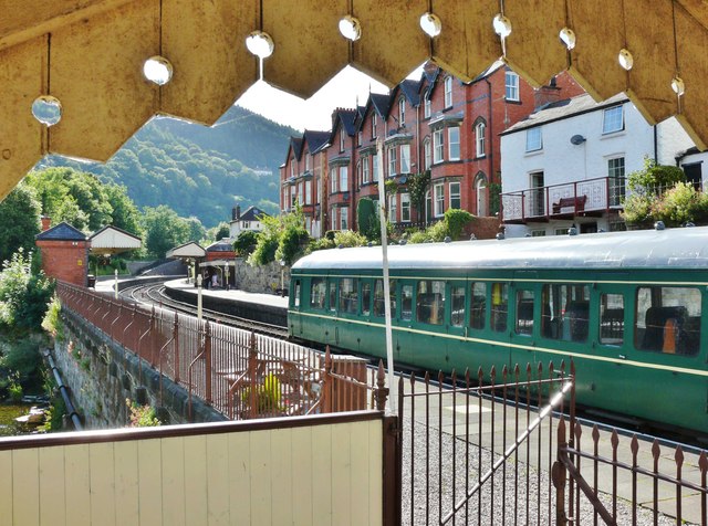
Image: © Flying Stag Taken: 5 Jul 2014
The station site is so cramped that one end of the footbridge had to be cantilevered out over the river. The photographer is standing a few steps up, directly over the water.
Images are licensed for reuse under creativecommons.org/licenses/by-sa/2.0
Image Location
Latitude
52.971538
Longitude
-3.173062