Watford High Street station, exterior
Introduction
The photograph on this page of Watford High Street station, exterior by Ben Brooksbank as part of the Geograph project.
The Geograph project started in 2005 with the aim of publishing, organising and preserving representative images for every square kilometre of Great Britain, Ireland and the Isle of Man.

There are currently over 7.5m images from over 14,400 individuals and you can help contribute to the project by visiting https://www.geograph.org.uk
Watford High Street station, exterior
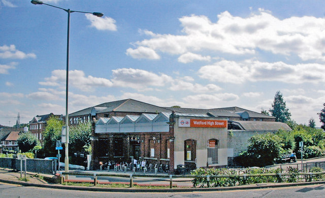
Image: © Ben Brooksbank Taken: 27 Aug 2009
View southward at Lower High Street, towards Bushey, Harrow and London on the railway. Built originally by the LNWR, Watford Junction - Rickmansworth/Croxley Green, LNWR electric trains after 1917: from 1922 LNWR electric trains also ran via Bushey & Oxhey to London (Euston/Broad Street), London Electric (Bakerloo Line) trains from Elephant & Castle having been extended from Queens Park. From 1926-27 the Rickmansworth (Church Street) and Croxley Green branches were electrified, but the Rickmansworth electric service ceased in 3/52, freight from 1/67; a service on the Croxley Green branch lasted until 3/96, but is planned to be revived in the form of the Croxley Link, substituting in part the ex-Metropolitan line from Moor Park to Watford (Met.).
Images are licensed for reuse under creativecommons.org/licenses/by-sa/2.0
Image Location
Latitude
51.652673
Longitude
-0.391841