Retaining walls, Bishopsteignton Road above Broadmeadow, Teignmouth
Introduction
The photograph on this page of Retaining walls, Bishopsteignton Road above Broadmeadow, Teignmouth by Robin Stott as part of the Geograph project.
The Geograph project started in 2005 with the aim of publishing, organising and preserving representative images for every square kilometre of Great Britain, Ireland and the Isle of Man.

There are currently over 7.5m images from over 14,400 individuals and you can help contribute to the project by visiting https://www.geograph.org.uk
Retaining walls, Bishopsteignton Road above Broadmeadow, Teignmouth
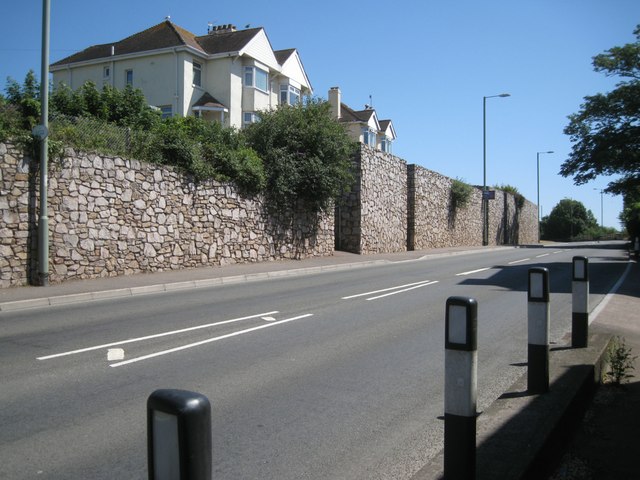
Image: © Robin Stott Taken: 6 Jul 2013
Over decades the Teignmouth Road-Bishopsteignton Road-Bitton Park Road A381 approach to the town has been widened. Cutting back into Teignmouth's steep slopes has required the construction of retaining walls. Judging by the lack of weathering to the Devonian limestone facing, these walls may have been built in the 1980s. Compare with those of around 1930: Image These widenings eased access to the town for visitors as well as the clay wagons going to the docks. The wide gap in the wall, centre, is where footpath no.1, Broadmeadow Lane, meets the road. The nearest house, perched above the road, is shown on the local street map as 'Leaside' and is seen behind the shed, left, in Image
Images are licensed for reuse under creativecommons.org/licenses/by-sa/2.0
Image Location
Latitude
50.546383
Longitude
-3.5131