The Kentford pub
Introduction
The photograph on this page of The Kentford pub by Bikeboy as part of the Geograph project.
The Geograph project started in 2005 with the aim of publishing, organising and preserving representative images for every square kilometre of Great Britain, Ireland and the Isle of Man.

There are currently over 7.5m images from over 14,400 individuals and you can help contribute to the project by visiting https://www.geograph.org.uk
The Kentford pub
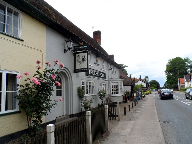
Image: © Bikeboy Taken: 28 Jun 2014
In 2013 it was still going by its traditional name of "The Cock" see http://www.geograph.org.uk/photo/3497184. It has been painted grey and the sign on the front has been changed. The building is a late C15 or early C16 coaching inn (see http://www.britishlistedbuildings.co.uk/en-275609-the-cock-public-house-kentford-suffolk ). It is a timber-framed building which was encased in brick in the C19. The pub lies on the B1506 which was the main A45 (now A14) road until 1975.
Images are licensed for reuse under creativecommons.org/licenses/by-sa/2.0
Image Location
Latitude
52.272542
Longitude
0.502337