Annalong's Orange Arch (detail)
Introduction
The photograph on this page of Annalong's Orange Arch (detail) by Eric Jones as part of the Geograph project.
The Geograph project started in 2005 with the aim of publishing, organising and preserving representative images for every square kilometre of Great Britain, Ireland and the Isle of Man.

There are currently over 7.5m images from over 14,400 individuals and you can help contribute to the project by visiting https://www.geograph.org.uk
Annalong's Orange Arch (detail)
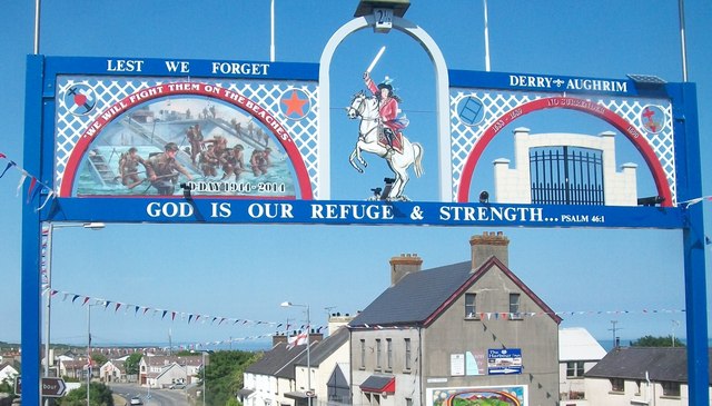
Image: © Eric Jones Taken: 1 Jul 2014
Centre stage is King William of Glorious Memory with on his left a panel commemorating the D-Day Landings of June 1944 and, on the right, the gates of Derry slammed shut in the face of James' army. Derry and Aughrim were the two decisive battles of the 1688-1690 campaign.
Images are licensed for reuse under creativecommons.org/licenses/by-sa/2.0
Image Location
Latitude
54.108099
Longitude
-5.900704