Norfolk & Norwich University Hospital (aerial)
Introduction
The photograph on this page of Norfolk & Norwich University Hospital (aerial) by Katy Walters as part of the Geograph project.
The Geograph project started in 2005 with the aim of publishing, organising and preserving representative images for every square kilometre of Great Britain, Ireland and the Isle of Man.

There are currently over 7.5m images from over 14,400 individuals and you can help contribute to the project by visiting https://www.geograph.org.uk
Norfolk & Norwich University Hospital (aerial)
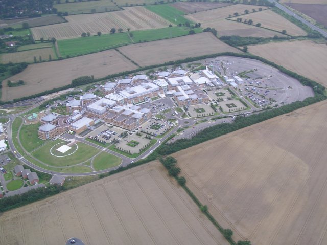
Image: © Katy Walters Taken: 20 Aug 2005
The hospital actually spans the four squares surrounding TG1807 so I have attributed it to that intersection. This photo was taken from approximately 1,000ft roughly over TG178074. The white square within the circle at the left of the photo is the air ambulance landing pad.
Images are licensed for reuse under creativecommons.org/licenses/by-sa/2.0
Image Location


Leaflet Map data © OpenStreetMap
Latitude
52.616985
Longitude
1.218873