Pike House Lock
Introduction
The photograph on this page of Pike House Lock by Paul Glazzard as part of the Geograph project.
The Geograph project started in 2005 with the aim of publishing, organising and preserving representative images for every square kilometre of Great Britain, Ireland and the Isle of Man.

There are currently over 7.5m images from over 14,400 individuals and you can help contribute to the project by visiting https://www.geograph.org.uk
Pike House Lock
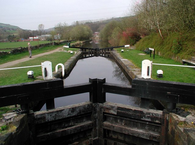
Image: © Paul Glazzard Taken: 12 Apr 2007
Pike House Lock No.45 on the Rochdale Canal northeast of Littleborough. The Rochdale Canal was completed in 1804 and covers 32 miles with 91 locks between Sowerby Bridge near Halifax and the Castlefield Basin, Manchester. Commercial use of the canal peaked in 1880 at about 50 boats a day but the last loaded barge travelled its full length in 1937 and from then on it fell into disrepair. The canal reopened in 2002 after a few years of refurbishment and is now used almost exclusively for leisure purposes.
Images are licensed for reuse under creativecommons.org/licenses/by-sa/2.0
Image Location
Latitude
53.652979
Longitude
-2.082721