Car park, Quay Street
Introduction
The photograph on this page of Car park, Quay Street by Christopher Hall as part of the Geograph project.
The Geograph project started in 2005 with the aim of publishing, organising and preserving representative images for every square kilometre of Great Britain, Ireland and the Isle of Man.

There are currently over 7.5m images from over 14,400 individuals and you can help contribute to the project by visiting https://www.geograph.org.uk
Car park, Quay Street
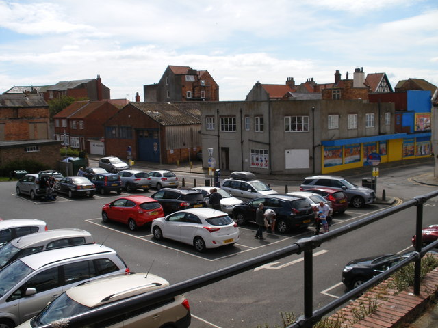
Image: © Christopher Hall Taken: 23 Jun 2014
Viewed from Long Greece Steps, this car park is on the site of Scarborough's first gas works. The gas works were started in the 1830s but in 1875 moved to a site near Seamer Road alongside the railway line. In the 1830s coal would have come in by sea. The gas works buildings then had various uses including an ice house for the fishing trade but were finally demolished in the early 1970s and this car park created.
Images are licensed for reuse under creativecommons.org/licenses/by-sa/2.0
Image Location
Latitude
54.284433
Longitude
-0.389855