
Bournemouth: some large-scale development activity
Introduction
The photograph on this page of Bournemouth: some large-scale development activity by Chris Downer as part of the Geograph project.
The Geograph project started in 2005 with the aim of publishing, organising and preserving representative images for every square kilometre of Great Britain, Ireland and the Isle of Man.

There are currently over 7.5m images from over 14,400 individuals and you can help contribute to the project by visiting https://www.geograph.org.uk
Bournemouth: some large-scale development activity
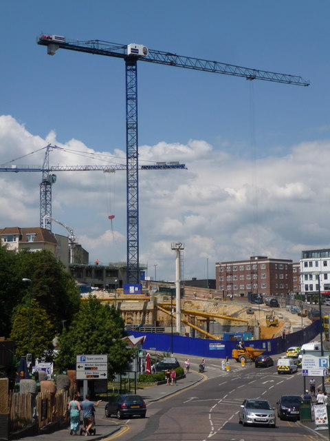
Image: © Chris Downer Taken: 23 Jun 2014
Until a couple of months ago it was a large, derelict lump of land at a much higher level - see the foot of the crane and the course of Terrace Road running alongside - along with a public car park at that higher level. The development is set to be a Hilton Hotel with a panoramic restaurant on the top (nineteenth) floor, along with the associated car parking and I believe 60 residential apartments. It is expected to be completed in 2016. Large supports hold the surrounding ground in place while the early excavation work (groundwork, one might say) continues on the site.
Images are licensed for reuse under creativecommons.org/licenses/by-sa/2.0
Image Location

Latitude
50.718746
Longitude
-1.880818