Trig Point on Potato Hill @197m asl
Introduction
The photograph on this page of Trig Point on Potato Hill @197m asl by Matthew Hatton as part of the Geograph project.
The Geograph project started in 2005 with the aim of publishing, organising and preserving representative images for every square kilometre of Great Britain, Ireland and the Isle of Man.

There are currently over 7.5m images from over 14,400 individuals and you can help contribute to the project by visiting https://www.geograph.org.uk
Trig Point on Potato Hill @197m asl
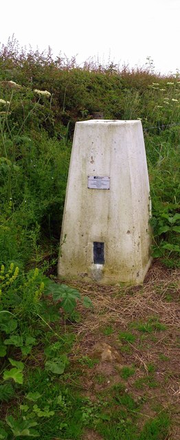
Image: © Matthew Hatton Taken: 21 Jun 2014
Half hidden by the hedge, sat in the corner of a field of arable crops, this trig point was in pretty good condition. On the plate it reads OS BM S4322.
Images are licensed for reuse under creativecommons.org/licenses/by-sa/2.0
Image Location
Latitude
54.50978
Longitude
-0.722055