
Lee on Solent Aerodrome: aerial 2014
Introduction
The photograph on this page of Lee on Solent Aerodrome: aerial 2014 by Chris as part of the Geograph project.
The Geograph project started in 2005 with the aim of publishing, organising and preserving representative images for every square kilometre of Great Britain, Ireland and the Isle of Man.

There are currently over 7.5m images from over 14,400 individuals and you can help contribute to the project by visiting https://www.geograph.org.uk
Lee on Solent Aerodrome: aerial 2014
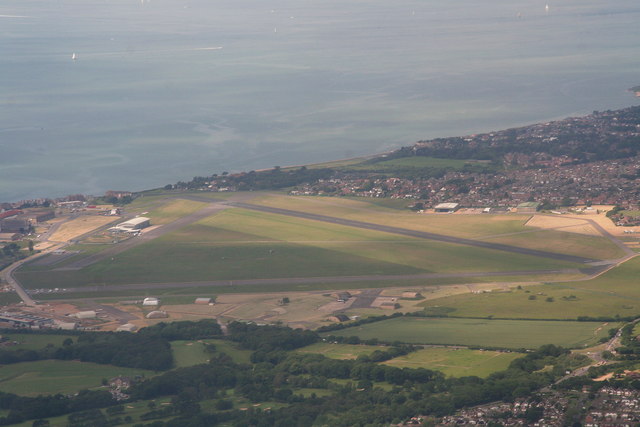
Image: © Chris Taken: 13 Jun 2014
Royal Naval Air Station Lee-on-Solent (HMS Daedalus) was one of the primary shore airfields of the Fleet Air Arm. First established as a seaplane base in 1917 during the First World War, it later became the main training establishment and administrative centre of the Fleet Air Arm. Situated near Lee-on-the-Solent in Hampshire, approximately four miles west of Portsmouth on the coast of the Solent. It is now a civilian airfield. See: http://www.eghf.co.uk/ and http://en.wikipedia.org/wiki/RNAS_Lee-on-Solent_(HMS_Daedalus)
Images are licensed for reuse under creativecommons.org/licenses/by-sa/2.0
Image Location

Latitude
50.816186
Longitude
-1.204753