Course of former Plynlimon & Hafan Tramway, near Tal-y-Bont
Introduction
The photograph on this page of Course of former Plynlimon & Hafan Tramway, near Tal-y-Bont by Ben Brooksbank as part of the Geograph project.
The Geograph project started in 2005 with the aim of publishing, organising and preserving representative images for every square kilometre of Great Britain, Ireland and the Isle of Man.

There are currently over 7.5m images from over 14,400 individuals and you can help contribute to the project by visiting https://www.geograph.org.uk
Course of former Plynlimon & Hafan Tramway, near Tal-y-Bont
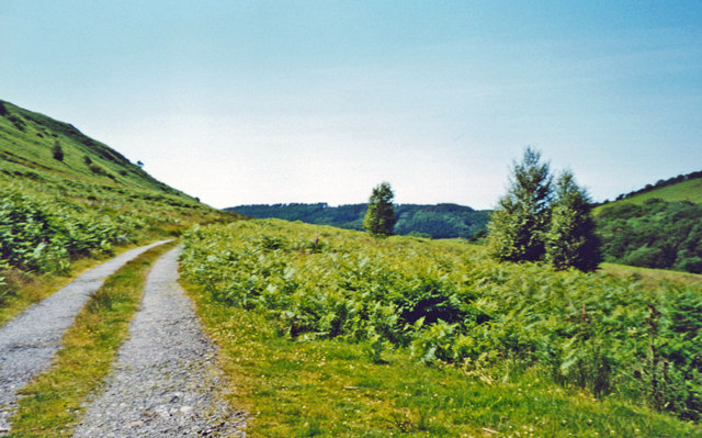
Image: © Ben Brooksbank Taken: 24 Jun 2004
View westward down the valley of the Afon Leri towards Tal-y-Bont village. The tramway, which was built in 1897 to transport minerals from the lead-mines at Bwlch Glas to the Cambrian Railway at Llandre, lasted only TWO years, but nevertheless carried passengers from Llandre as far as Tal-y-Bont! The mountain up to the left is Braich Garw. (This must be one of the most obscure 'Sites of a Railway Station').
Images are licensed for reuse under creativecommons.org/licenses/by-sa/2.0
Image Location
Latitude
52.479798
Longitude
-3.970132