Walton Bridge
Introduction
The photograph on this page of Walton Bridge by philandju as part of the Geograph project.
The Geograph project started in 2005 with the aim of publishing, organising and preserving representative images for every square kilometre of Great Britain, Ireland and the Isle of Man.

There are currently over 7.5m images from over 14,400 individuals and you can help contribute to the project by visiting https://www.geograph.org.uk
Walton Bridge
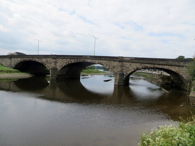
Image: © philandju Taken: 19 Jun 2014
Carrying the A6 over the Ribble. The bridge was earlier called Ribble Bridge. It was built in 1779 - 1781 by John S. & Rob. Laws under the inspection of Mr. Richard Threlfall at a cost of £4200 (approximately £500,000 at today's values).
Images are licensed for reuse under creativecommons.org/licenses/by-sa/2.0
Image Location


Leaflet Map data © OpenStreetMap
Latitude
53.752826
Longitude
-2.679533