Near Auchencrieve
Introduction
The photograph on this page of Near Auchencrieve by Anne Burgess as part of the Geograph project.
The Geograph project started in 2005 with the aim of publishing, organising and preserving representative images for every square kilometre of Great Britain, Ireland and the Isle of Man.

There are currently over 7.5m images from over 14,400 individuals and you can help contribute to the project by visiting https://www.geograph.org.uk
Near Auchencrieve
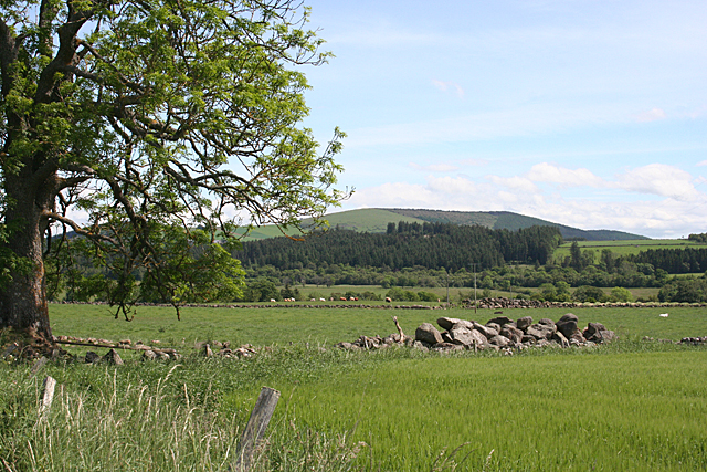
Image: © Anne Burgess Taken: 18 Jun 2014
The heap of boulders in the field wall gives some idea of what the farmer has had to contend with. These will be erratics dropped by melting glaciers at the end of the last Ice Age. The crop looks like barley. In the distance is Fourman Hill.
Images are licensed for reuse under creativecommons.org/licenses/by-sa/2.0
Image Location
Latitude
57.51691
Longitude
-2.789747