Flush Bracket, Ballyclare
Introduction
The photograph on this page of Flush Bracket, Ballyclare by Rossographer as part of the Geograph project.
The Geograph project started in 2005 with the aim of publishing, organising and preserving representative images for every square kilometre of Great Britain, Ireland and the Isle of Man.

There are currently over 7.5m images from over 14,400 individuals and you can help contribute to the project by visiting https://www.geograph.org.uk
Flush Bracket, Ballyclare
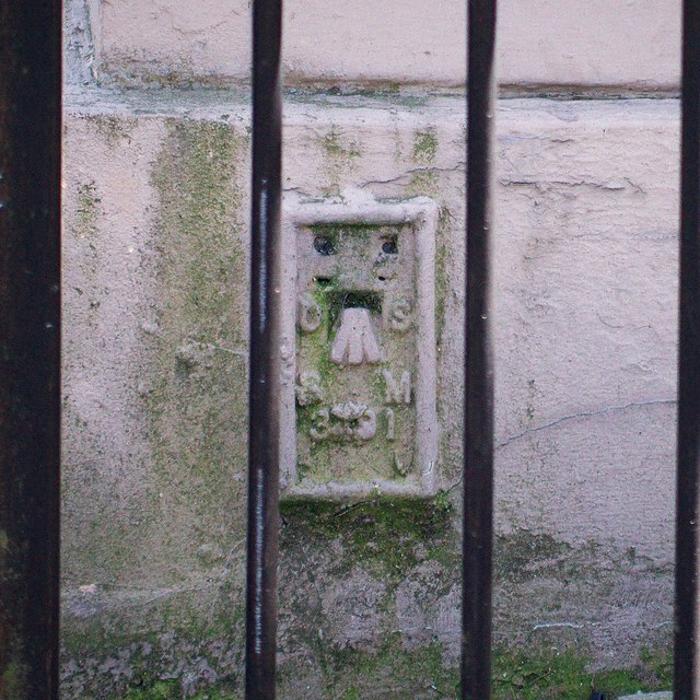
Image: © Rossographer Taken: 15 Jun 2014
Flush bracket bench mark on the north-eastern corner of Ballyclare Town Hall Image The number on the bracket is OSBM 3491 (a bit fuzzy as it is partially covered over and enclosed by two sets of railings - this was taken with a long zoom lens). The mark has been levelled to 74.05 metres above MSL.
Images are licensed for reuse under creativecommons.org/licenses/by-sa/2.0
Image Location
Latitude
54.752198
Longitude
-6.001459