Former railway station, Kingsland
Introduction
The photograph on this page of Former railway station, Kingsland by John Winder as part of the Geograph project.
The Geograph project started in 2005 with the aim of publishing, organising and preserving representative images for every square kilometre of Great Britain, Ireland and the Isle of Man.

There are currently over 7.5m images from over 14,400 individuals and you can help contribute to the project by visiting https://www.geograph.org.uk
Former railway station, Kingsland
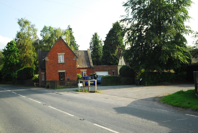
Image: © John Winder Taken: 15 Jun 2014
The old railway station on the former Leominster - Kington branch, opened from Leominster to Pembridge (just up the line from here) in 1855, and throughout in 1857. The route underwent the usual post - WW1 decline, with an unexpected boost to traffic levels owing to the construction during WW2 of two US forces hospitals at Kington, safely out of reach of the Luftwaffe. Traffic volumes went into a terminal tailspin following the end of the war, and the line eventually closed to all traffic in 1964. Ben Brooksbank gives more detail at Image The station remains in good condition and there are more railway buildings in the former goods yard, which is now a timber yard and the base of Border Oak Homes. If we're being strictly accurate, the station building is the white painted building mostly hidden behind the large tree to the right of centre: the red brick building was actually the crossing keeper's cottage.
Images are licensed for reuse under creativecommons.org/licenses/by-sa/2.0
Image Location
Latitude
52.243878
Longitude
-2.820567