Wheelchair/disabled ramp, Downshire station, Carrickfergus (June 2014)
Introduction
The photograph on this page of Wheelchair/disabled ramp, Downshire station, Carrickfergus (June 2014) by Albert Bridge as part of the Geograph project.
The Geograph project started in 2005 with the aim of publishing, organising and preserving representative images for every square kilometre of Great Britain, Ireland and the Isle of Man.

There are currently over 7.5m images from over 14,400 individuals and you can help contribute to the project by visiting https://www.geograph.org.uk
Wheelchair/disabled ramp, Downshire station, Carrickfergus (June 2014)
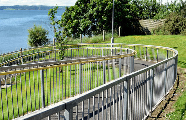
Image: © Albert Bridge Taken: 15 Jun 2014
Part of the spiral wheelchair/disabled ramp leading to the up platform at Downshire station. The platforms are very close to the bridge on the Larne Road (left in Image) which restricted the available space when the ramp was added.
Images are licensed for reuse under creativecommons.org/licenses/by-sa/2.0
Image Location
Latitude
54.720575
Longitude
-5.791548