The Dower House. Stoke Park, Bristol
Introduction
The photograph on this page of The Dower House. Stoke Park, Bristol by John Phillips as part of the Geograph project.
The Geograph project started in 2005 with the aim of publishing, organising and preserving representative images for every square kilometre of Great Britain, Ireland and the Isle of Man.

There are currently over 7.5m images from over 14,400 individuals and you can help contribute to the project by visiting https://www.geograph.org.uk
The Dower House. Stoke Park, Bristol
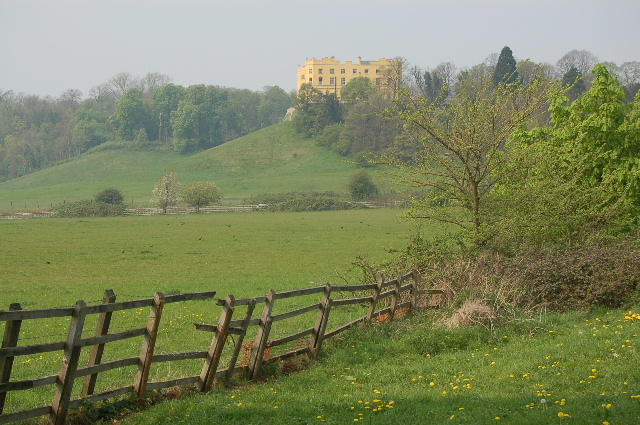
Image: © John Phillips Taken: 15 Apr 2007
Now luxury flats, the Dower House is on the edge of the new housing development of Stoke Park which is just outside the Bristol City boundary into South Gloucestershire. The M32 Motorway into Bristol is in a cutting, not clearly shown on the OS Map, through the middle of this photo.
Images are licensed for reuse under creativecommons.org/licenses/by-sa/2.0
Image Location
Latitude
51.493461
Longitude
-2.545868