St George Wharf development and Vauxhall Bridge
Introduction
The photograph on this page of St George Wharf development and Vauxhall Bridge by Marathon as part of the Geograph project.
The Geograph project started in 2005 with the aim of publishing, organising and preserving representative images for every square kilometre of Great Britain, Ireland and the Isle of Man.

There are currently over 7.5m images from over 14,400 individuals and you can help contribute to the project by visiting https://www.geograph.org.uk
St George Wharf development and Vauxhall Bridge
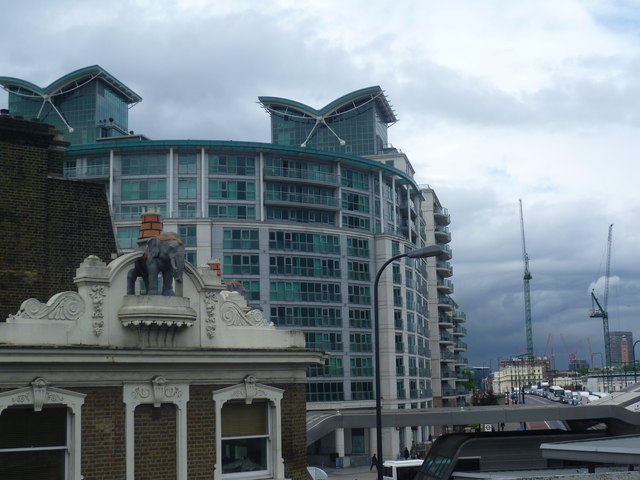
Image: © Marathon Taken: 4 Jun 2014
This is the view from Vauxhall station looking towards part of the St George Wharf development on the left and Vauxhall Bridge straight ahead. On the left is the roof of the former Elephant and Castle pub which is now a branch of Starbucks. For a close up of the elephant and its castle see http://www.geograph.org.uk/photo/4025020
Images are licensed for reuse under creativecommons.org/licenses/by-sa/2.0
Image Location


Leaflet Map data © OpenStreetMap
Latitude
51.486128
Longitude
-0.124764