Development site, Trostan Avenue, Ballymena (June 2014)
Introduction
The photograph on this page of Development site, Trostan Avenue, Ballymena (June 2014) by Albert Bridge as part of the Geograph project.
The Geograph project started in 2005 with the aim of publishing, organising and preserving representative images for every square kilometre of Great Britain, Ireland and the Isle of Man.

There are currently over 7.5m images from over 14,400 individuals and you can help contribute to the project by visiting https://www.geograph.org.uk
Development site, Trostan Avenue, Ballymena (June 2014)
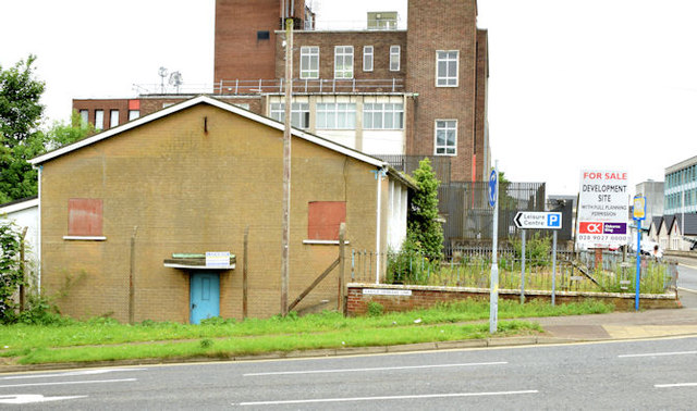
Image: © Albert Bridge Taken: 13 Jun 2014
A vacant building, at the corner of Trostan Avenue (right) and Castle Demesne Link offered for sale and described by the agents as “The subject property was formerly the Ballymena Senior Citizens Club and is located on a square shaped site extending to approximately 0.19 acres with 26m (86 ft.) of frontage onto Trostan Avenue. . . . . Planning has been passed for a proposed scheme incorporating 4 storeys of open plan Grade A office accommodation, with 15 car parking spaces in the basement totalling 15,349 sq.ft. Planning Application No. G/2009/0207/F”. This photograph appears as a matter of geographical and historical record only. I have no connection with any of the parties involved in the sale.
Images are licensed for reuse under creativecommons.org/licenses/by-sa/2.0
Image Location
Latitude
54.862492
Longitude
-6.270539