Rock House and Highfield House, Wellow
Introduction
The photograph on this page of Rock House and Highfield House, Wellow by Alan Murray-Rust as part of the Geograph project.
The Geograph project started in 2005 with the aim of publishing, organising and preserving representative images for every square kilometre of Great Britain, Ireland and the Isle of Man.

There are currently over 7.5m images from over 14,400 individuals and you can help contribute to the project by visiting https://www.geograph.org.uk
Rock House and Highfield House, Wellow
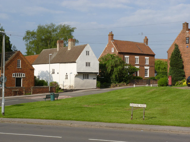
Image: © Alan Murray-Rust Taken: 1 Jun 2014
Two historic properties on Newark Road, both Listed Grade II. Rock House (left) is a partly timber framed house dating back to the 17th century. Highfield House is a mid 18th former farmhouse.
Images are licensed for reuse under creativecommons.org/licenses/by-sa/2.0
Image Location
Latitude
53.188768
Longitude
-0.998438