Auchinbaird Windmill
Introduction
The photograph on this page of Auchinbaird Windmill by John Chroston as part of the Geograph project.
The Geograph project started in 2005 with the aim of publishing, organising and preserving representative images for every square kilometre of Great Britain, Ireland and the Isle of Man.

There are currently over 7.5m images from over 14,400 individuals and you can help contribute to the project by visiting https://www.geograph.org.uk
Auchinbaird Windmill
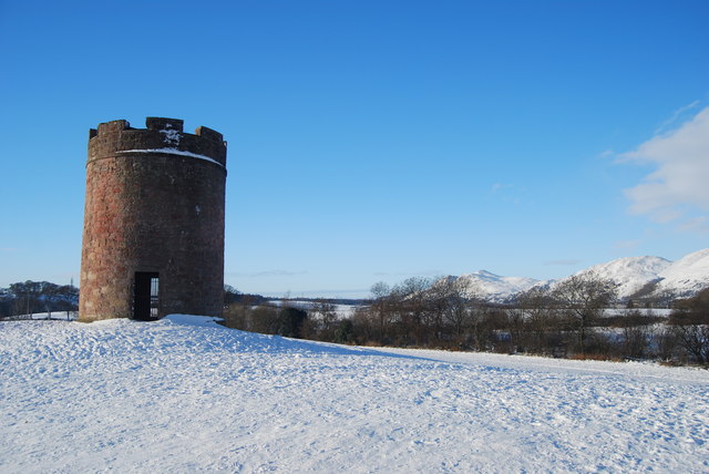
Image: © John Chroston Taken: 2 Dec 2010
Built in the early 18th century to power the draining of the local coal pit then used as a dovecot following the closure of the coal pit.
Images are licensed for reuse under creativecommons.org/licenses/by-sa/2.0
Image Location
Latitude
56.134772
Longitude
-3.774431