Saunderton - SS Mary & Nicholas - Southern fa?ade
Introduction
The photograph on this page of Saunderton - SS Mary & Nicholas - Southern fa?ade by Rob Farrow as part of the Geograph project.
The Geograph project started in 2005 with the aim of publishing, organising and preserving representative images for every square kilometre of Great Britain, Ireland and the Isle of Man.

There are currently over 7.5m images from over 14,400 individuals and you can help contribute to the project by visiting https://www.geograph.org.uk
Saunderton - SS Mary & Nicholas - Southern fa?ade
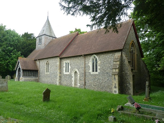
Image: © Rob Farrow Taken: 31 May 2014
The little C19th church of SS Mary & Nicholas in Saunderton takes a bit of finding, tucked away up a path off a narrow dead-end lane in this tiny village. The church was locked, but fortunately I was able to obtain the key from a nearby householder. The present building stands on the site of a church dating back to the early C13th. This older church may itself have replaced an even earlier Saxon or Norman one, as it houses a C12th Norman "Aylesbury" font http://www.geograph.org.uk/photo/4020961 The C13th church was destroyed by fire in the early C19th and the current building was built incorporating as much of the old church as possible, including restored C14 windows and doorways. The timber frame of the bell tower is thought to date from the C15th. And of course there is the ancient font. The church is EH Grade II* listed http://list.english-heritage.org.uk/resultsingle.aspx?uid=1332059&searchtype=mapsearch
Images are licensed for reuse under creativecommons.org/licenses/by-sa/2.0
Image Location
Latitude
51.710025
Longitude
-0.850073