Marischal Street
Introduction
The photograph on this page of Marischal Street by Colin Smith as part of the Geograph project.
The Geograph project started in 2005 with the aim of publishing, organising and preserving representative images for every square kilometre of Great Britain, Ireland and the Isle of Man.

There are currently over 7.5m images from over 14,400 individuals and you can help contribute to the project by visiting https://www.geograph.org.uk
Marischal Street
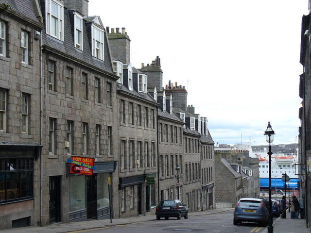
Image: © Colin Smith Taken: 9 Apr 2007
Famous old street descending from Castlegate to Aberdeen Harbour. This is the city's first flyover, being built on embankments and arches across Virginia Street. These Georgian houses are built of Loanhead granite - quarried in the Rosemount area. The blue ship in the distance is one of the "North Boats" which service Orkney and Shetland.
Images are licensed for reuse under creativecommons.org/licenses/by-sa/2.0
Image Location
Latitude
57.147282
Longitude
-2.093026