Plaque, Hope Methodist Chapel, Black Torrington
Introduction
The photograph on this page of Plaque, Hope Methodist Chapel, Black Torrington by Derek Harper as part of the Geograph project.
The Geograph project started in 2005 with the aim of publishing, organising and preserving representative images for every square kilometre of Great Britain, Ireland and the Isle of Man.

There are currently over 7.5m images from over 14,400 individuals and you can help contribute to the project by visiting https://www.geograph.org.uk
Plaque, Hope Methodist Chapel, Black Torrington
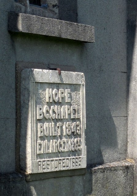
Image: © Derek Harper Taken: 31 May 2014
Evidence for the dates given in Image The plaque is on the south wall facing the burial ground.
Images are licensed for reuse under creativecommons.org/licenses/by-sa/2.0
Image Location
Latitude
50.827042
Longitude
-4.179313