Hope Methodist Chapel, Black Torrington
Introduction
The photograph on this page of Hope Methodist Chapel, Black Torrington by Derek Harper as part of the Geograph project.
The Geograph project started in 2005 with the aim of publishing, organising and preserving representative images for every square kilometre of Great Britain, Ireland and the Isle of Man.

There are currently over 7.5m images from over 14,400 individuals and you can help contribute to the project by visiting https://www.geograph.org.uk
Hope Methodist Chapel, Black Torrington
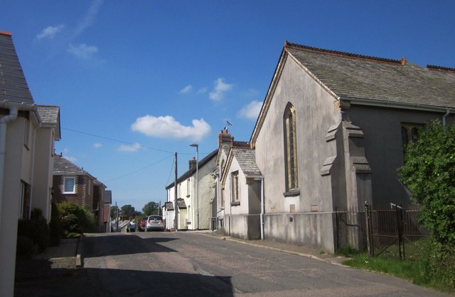
Image: © Derek Harper Taken: 31 May 2014
Formerly a Bible Christian chapel, built in 1843, enlarged in 1865 and restored in 1885 (the dates appear in Image]), at the southern end of the village street at the top of Bonfire Hill. See also Image] and Image
Images are licensed for reuse under creativecommons.org/licenses/by-sa/2.0
Image Location
Latitude
50.827039
Longitude
-4.179454