Butt Road Roman Church
Introduction
The photograph on this page of Butt Road Roman Church by Mike Quinn as part of the Geograph project.
The Geograph project started in 2005 with the aim of publishing, organising and preserving representative images for every square kilometre of Great Britain, Ireland and the Isle of Man.

There are currently over 7.5m images from over 14,400 individuals and you can help contribute to the project by visiting https://www.geograph.org.uk
Butt Road Roman Church
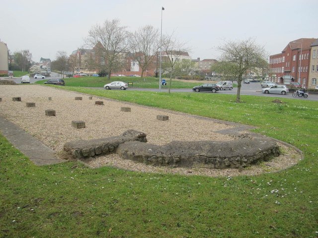
Image: © Mike Quinn Taken: 2 Apr 2014
The Wiki entry says that "Excavations in the 1980s for a new police station near the Maldon Road roundabout unearthed 371 Roman graves and a long narrow building. The building was built between AD 320 and 340. Oriented east to west, an apse was added to the east end in a later phase. The building was divided by a wooden screen and two rows of posts ran down the eastern half forming aisles. The building has been interpreted on strong circumstantial evidence as an early Christian church. If this is correct, it is probably the earliest known Christian church in Britain."
Images are licensed for reuse under creativecommons.org/licenses/by-sa/2.0
Image Location
Latitude
51.886591
Longitude
0.893726