Moira school
Introduction
The photograph on this page of Moira school by Robert Ashby as part of the Geograph project.
The Geograph project started in 2005 with the aim of publishing, organising and preserving representative images for every square kilometre of Great Britain, Ireland and the Isle of Man.

There are currently over 7.5m images from over 14,400 individuals and you can help contribute to the project by visiting https://www.geograph.org.uk
Moira school
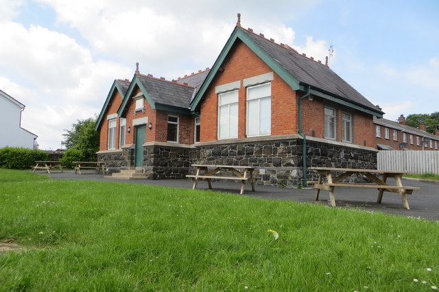
Image: © Robert Ashby Taken: 31 May 2014
The former Moira Public Elementary School which the rather weathered stone tablet above the door says was built 1908. Now The Logic Cafe which seemingly caters to 12-18 year olds according to the sign on the fence.
Images are licensed for reuse under creativecommons.org/licenses/by-sa/2.0
Image Location
Latitude
54.479788
Longitude
-6.229181