Manor Farm House and Manor Farm Cottage, Studland
Introduction
The photograph on this page of Manor Farm House and Manor Farm Cottage, Studland by Carol Walker as part of the Geograph project.
The Geograph project started in 2005 with the aim of publishing, organising and preserving representative images for every square kilometre of Great Britain, Ireland and the Isle of Man.

There are currently over 7.5m images from over 14,400 individuals and you can help contribute to the project by visiting https://www.geograph.org.uk
Manor Farm House and Manor Farm Cottage, Studland
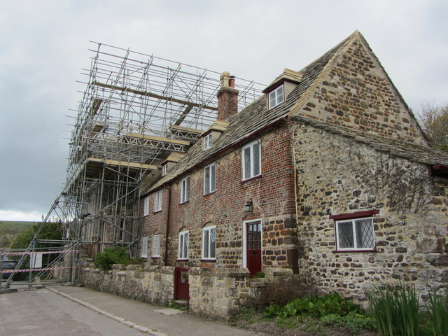
Image: © Carol Walker Taken: 30 May 2014
There is extensive work being carried out on this National Trust owned property. It has been listed since 1959.The original parts of the building date from the 18th century, with later additions in about 1870. It is easy to see the mix of rubble stone and brick construction. Even the front boundary wall is listed, being of stone construction with battlements.
Images are licensed for reuse under creativecommons.org/licenses/by-sa/2.0
Image Location
Latitude
50.641819
Longitude
-1.950026