Utility and survey
Introduction
The photograph on this page of Utility and survey by Neil Owen as part of the Geograph project.
The Geograph project started in 2005 with the aim of publishing, organising and preserving representative images for every square kilometre of Great Britain, Ireland and the Isle of Man.

There are currently over 7.5m images from over 14,400 individuals and you can help contribute to the project by visiting https://www.geograph.org.uk
Utility and survey
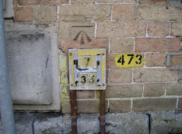
Image: © Neil Owen Taken: 26 May 2014
Some familiar urban signs on the wall of a dentists surgery. A fire hydrant plate, denoting the size of supply pipe and distance from the plate, and an Ordnance Survey benchmark (dating from the nineteenth century) above it. See http://www.bench-marks.org.uk/bm57695 for the entry in the Benchmark Database and Image] for a view of Yarde House.
Images are licensed for reuse under creativecommons.org/licenses/by-sa/2.0
Image Location
Latitude
51.019132
Longitude
-3.106136