West Highland Way at Easter Carbeth
Introduction
The photograph on this page of West Highland Way at Easter Carbeth by Lairich Rig as part of the Geograph project.
The Geograph project started in 2005 with the aim of publishing, organising and preserving representative images for every square kilometre of Great Britain, Ireland and the Isle of Man.

There are currently over 7.5m images from over 14,400 individuals and you can help contribute to the project by visiting https://www.geograph.org.uk
West Highland Way at Easter Carbeth
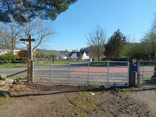
Image: © Lairich Rig Taken: 18 Apr 2014
The West Highland Way and the John Muir Way coincide in this area; there is a small purple-and-white marker for the John Muir Way on the upper part of the signpost. Both routes follow a path southwards up to this gate, where they meet the main road(*). They then turn left, following the road eastwards for a distance of about 300 metres: see Image, taken beside the same gate. The routes then leave the road again at Image, near which point the John Muir Way and the West Highland Way separate: Image In this view, the buildings of Easter Carbeth Farm can be seen across the road. For a view in the opposite direction, looking across this gate from the other side, see Image (*) At the time of writing, large-scale OS mapping calls this part of the road Ballachalairy Yett. I believe this to be a mistake. Early OS maps employed the name correctly (Image), but at some point since then, someone, most likely not knowing that "yett" is Scots for "gate", has misunderstood the name as applying to the road.
Images are licensed for reuse under creativecommons.org/licenses/by-sa/2.0
Image Location
Latitude
55.987416
Longitude
-4.353006