Lower Mead/Upper Mead/Three Acres (2)
Introduction
The photograph on this page of Lower Mead/Upper Mead/Three Acres (2) by Simon Carey as part of the Geograph project.
The Geograph project started in 2005 with the aim of publishing, organising and preserving representative images for every square kilometre of Great Britain, Ireland and the Isle of Man.

There are currently over 7.5m images from over 14,400 individuals and you can help contribute to the project by visiting https://www.geograph.org.uk
Lower Mead/Upper Mead/Three Acres (2)
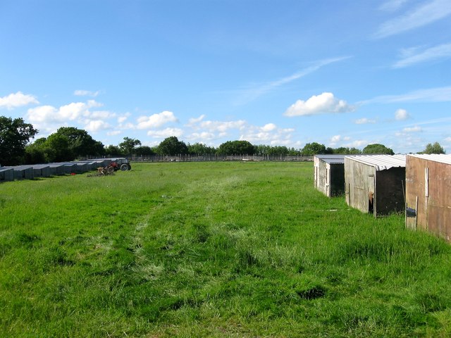
Image: © Simon Carey Taken: 25 May 2014
The name of the fields according to Albourne's 1839 tithe map that have been joined together to make a larger unit. Lower Mead was in the foreground adjacent to the footpath that links Church Lane to Trusler's Hill Lane, whilst Upper mead was at the far end to the left and Three Acres far end to the right. the field, which seems to be in the process of being converted into a poultry farm, lies between Image to the east and Image to the west. See also Image
Images are licensed for reuse under creativecommons.org/licenses/by-sa/2.0
Image Location
Latitude
50.936612
Longitude
-0.219401