West Highland Way near Woodside House
Introduction
The photograph on this page of West Highland Way near Woodside House by Lairich Rig as part of the Geograph project.
The Geograph project started in 2005 with the aim of publishing, organising and preserving representative images for every square kilometre of Great Britain, Ireland and the Isle of Man.

There are currently over 7.5m images from over 14,400 individuals and you can help contribute to the project by visiting https://www.geograph.org.uk
West Highland Way near Woodside House
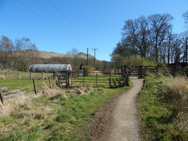
Image: © Lairich Rig Taken: 18 Apr 2014
The path is also part of the John Muir Way. At the far left, seen indistinctly through the trees, is a concrete structure that is part of a Image (the structure can be seen, left of centre, in that view). Nearer, to the left of the gates, is a polytunnel. In the background, Dumgoyne Image is prominent on the edge of the Campsie Hills.
Images are licensed for reuse under creativecommons.org/licenses/by-sa/2.0
Image Location
Latitude
56.029806
Longitude
-4.382712