The curious case of the lowered hill
Introduction
The photograph on this page of The curious case of the lowered hill by Neil Owen as part of the Geograph project.
The Geograph project started in 2005 with the aim of publishing, organising and preserving representative images for every square kilometre of Great Britain, Ireland and the Isle of Man.

There are currently over 7.5m images from over 14,400 individuals and you can help contribute to the project by visiting https://www.geograph.org.uk
The curious case of the lowered hill
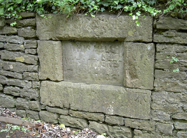
Image: © Neil Owen Taken: 13 May 2014
This stone in Styles Hill has weathered a bit but seems to read: This hill was lowered 7 ??? 1861 It also has a benchmark too (an original from the nineteenth century) - see http://www.bench-marks.org.uk/bm57378 for the entry in the Benchmark Database and Image] for a wider view.
Images are licensed for reuse under creativecommons.org/licenses/by-sa/2.0
Image Location


Leaflet Map data © OpenStreetMap
Latitude
51.228812
Longitude
-2.304279