Crymych, Pembrokeshire
Introduction
The photograph on this page of Crymych, Pembrokeshire by Dylan Moore as part of the Geograph project.
The Geograph project started in 2005 with the aim of publishing, organising and preserving representative images for every square kilometre of Great Britain, Ireland and the Isle of Man.

There are currently over 7.5m images from over 14,400 individuals and you can help contribute to the project by visiting https://www.geograph.org.uk
Crymych, Pembrokeshire
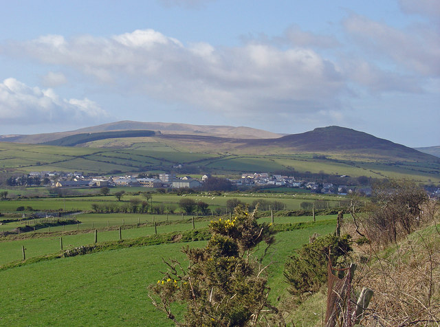
Image: © Dylan Moore Taken: 13 Mar 2007
A distant view shows Crymych under the Preseli ridge, with Foel Drygarn above it to the right (north) and the plantation of Llethr to the left. The high ridge beyond has Feol Feddau to the right and Foel Cwmcerwyn (the highest point in SW Wales at 536 m) to the left. Crymych is located in the saddle in the Preseli ridge through which the main Cardigan-Narberth road passes. There was no real settlement here until the railway line to Cardigan was built through the pass in 1874, whereupon the station became a depot for the scattered enclosure farms of the area, and shops and services grew up around this. It still functions as the commercial and cultural centre of the hill country, and includes (centre view) the local Welsh-language comprehensive school.
Images are licensed for reuse under creativecommons.org/licenses/by-sa/2.0
Image Location


Leaflet Map data © OpenStreetMap
Latitude
51.971048
Longitude
-4.648483