Heywood Community School RoSLA Block and Playing Fields (2010)
Introduction
The photograph on this page of Heywood Community School RoSLA Block and Playing Fields (2010) by David Dixon as part of the Geograph project.
The Geograph project started in 2005 with the aim of publishing, organising and preserving representative images for every square kilometre of Great Britain, Ireland and the Isle of Man.

There are currently over 7.5m images from over 14,400 individuals and you can help contribute to the project by visiting https://www.geograph.org.uk
Heywood Community School RoSLA Block and Playing Fields (2010)
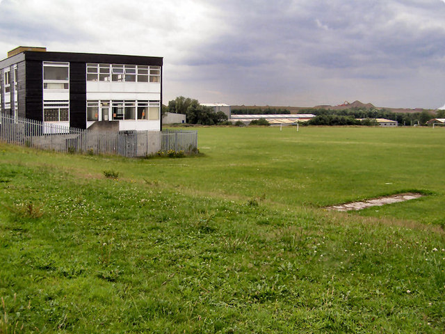
Image: © David Dixon Taken: 19 Jul 2010
Sutherland High School, on Sutherland Road at Darnhill, was opened in 1966. Its name was changed to Heywood Community School in the 1990s. The block on the left was built in the early 1970s when the school-leaving age was raised from 15 to 16 (RoSLA). Closed in June 2010 (http://menmedia.co.uk/heywoodadvertiser/news/s/1193762_school_party_to_mark_the_end_of_an_era - Heywood Advertiser and http://news.bbc.co.uk/local/manchester/hi/people_and_places/newsid_8940000/8940501.stm - BBC Education), the school was demolished during the winter of 2010-11 and, by 2014, a development of new houses was being built. There is now little or no evidence to show that the school buildings once stood on this site.
Images are licensed for reuse under creativecommons.org/licenses/by-sa/2.0
Image Location
Latitude
53.588203
Longitude
-2.2536