Curtains, The Street, Albourne
Introduction
The photograph on this page of Curtains, The Street, Albourne by Simon Carey as part of the Geograph project.
The Geograph project started in 2005 with the aim of publishing, organising and preserving representative images for every square kilometre of Great Britain, Ireland and the Isle of Man.

There are currently over 7.5m images from over 14,400 individuals and you can help contribute to the project by visiting https://www.geograph.org.uk
Curtains, The Street, Albourne
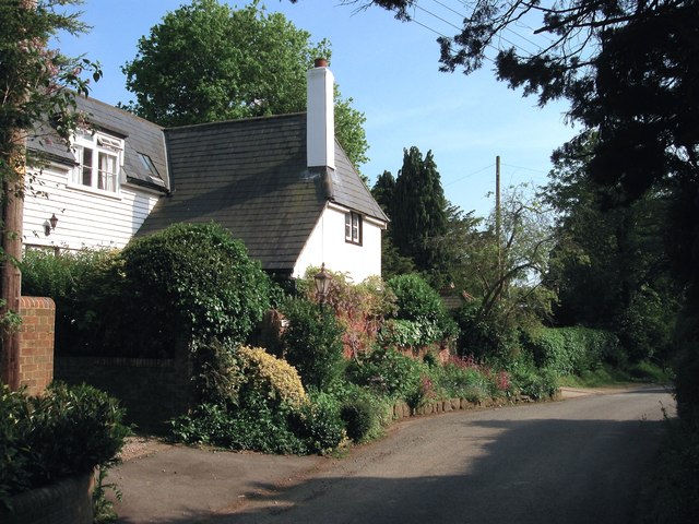
Image: © Simon Carey Taken: 16 May 2014
A t-shaped cottage on The Street of varying age located to the north of Image; the wing abutting the road was built in the 17th century, that to the south out of shot was added in the 18th, whilst the northern portion is a modern extension. All the cottages lining the road from the south of The Twitten were originally part of Albourne Street believed to have been created as a settlement around the 15th-16th century by the lords of the manor of Bishopshurst, who resided at what is now Bishops Place to the south of the village.
Images are licensed for reuse under creativecommons.org/licenses/by-sa/2.0
Image Location
Latitude
50.934454
Longitude
-0.201836