Kinson: the Smuggler?s Wain
Introduction
The photograph on this page of Kinson: the Smuggler?s Wain by Chris Downer as part of the Geograph project.
The Geograph project started in 2005 with the aim of publishing, organising and preserving representative images for every square kilometre of Great Britain, Ireland and the Isle of Man.

There are currently over 7.5m images from over 14,400 individuals and you can help contribute to the project by visiting https://www.geograph.org.uk
Kinson: the Smuggler?s Wain
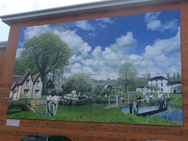
Image: © Chris Downer Taken: 15 May 2014
A new piece of artwork adorning the back wall of Image, depicting elements of Kinson's past. Towards the back is Pelhams House, complete with the present-day signage of the community centre; to the left is one of the Lady Wimborne Cottages (which are dotted around the local area; see for example Image); St. Andrew's parish church stands close to the river Stour. Bygone people scenes in black and white complete the picture. The name comes from Kinson's strong smuggling heritage; the coast along these parts was a hotbed of smuggling activity and inspired Gulliver's Travels (most noticeable in the suburb name Lilliput, in Poole) and particularly Kinson parish church was a well known storage place. See Image for a wider view of the mural in its surroundings.
Images are licensed for reuse under creativecommons.org/licenses/by-sa/2.0
Image Location


Leaflet Map data © OpenStreetMap
Latitude
50.769304
Longitude
-1.901677