Drill Hall
Introduction
The photograph on this page of Drill Hall by Anne Burgess as part of the Geograph project.
The Geograph project started in 2005 with the aim of publishing, organising and preserving representative images for every square kilometre of Great Britain, Ireland and the Isle of Man.

There are currently over 7.5m images from over 14,400 individuals and you can help contribute to the project by visiting https://www.geograph.org.uk
Drill Hall
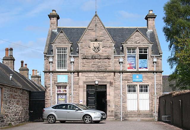
Image: © Anne Burgess Taken: 12 May 2014
The Drill Hall was opened in March 1910 by General Forbes MacBean. It stands on the site of an earlier wooden building. The architect was Charles Chree Doig.
Images are licensed for reuse under creativecommons.org/licenses/by-sa/2.0
Image Location


Leaflet Map data © OpenStreetMap
Latitude
57.61207
Longitude
-3.609646