Site former Radstock Stations, 2006
Introduction
The photograph on this page of Site former Radstock Stations, 2006 by Ben Brooksbank as part of the Geograph project.
The Geograph project started in 2005 with the aim of publishing, organising and preserving representative images for every square kilometre of Great Britain, Ireland and the Isle of Man.

There are currently over 7.5m images from over 14,400 individuals and you can help contribute to the project by visiting https://www.geograph.org.uk
Site former Radstock Stations, 2006
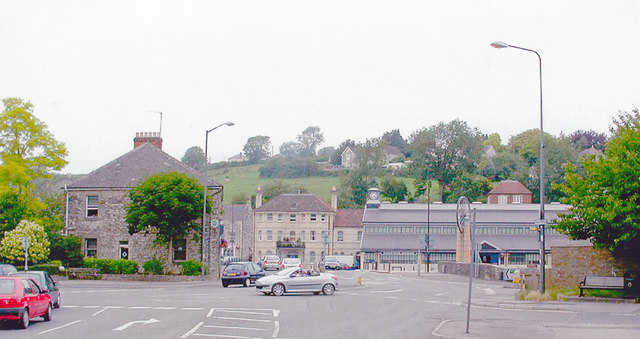
Image: © Ben Brooksbank Taken: 2 Jul 2006
View southward from the A367 Wells Road, in the centre of town where the two stations used to be, side by side. Nearest was the ex-GWR (Bristol, Radstock & Frome line) - Frome to the left (closed 2/11/59, goods 15/6/64). Just beyond was the Somerset & Dorset station ('Radstock North' from 9/49) on the S&D Bath (to left) - Evercreech Junction - Templecombe - Bournemouth West main line (closed 7/3/66)
Images are licensed for reuse under creativecommons.org/licenses/by-sa/2.0
Image Location
Latitude
51.292911
Longitude
-2.448259