Polapit Tamar House
Introduction
The photograph on this page of Polapit Tamar House by Chris Martyn as part of the Geograph project.
The Geograph project started in 2005 with the aim of publishing, organising and preserving representative images for every square kilometre of Great Britain, Ireland and the Isle of Man.

There are currently over 7.5m images from over 14,400 individuals and you can help contribute to the project by visiting https://www.geograph.org.uk
Polapit Tamar House
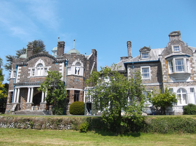
Image: © Chris Martyn Taken: 6 Jun 2013
The house, now a Grade II Listed Building, was built in 1866 for the Coode family who owned the land round about, in the Tamar Valley to the north of Werrington. The original structure (right side, in the picture) dates from 1866 and the remainder (left side) from 1903. It is said that Mr R C Coode commissioned the extension for his daughter's twenty-first birthday; its principal room is an oak-panelled ballroom with ornately carved chimney-pieces. This picture was taken from the lawns of the garden below the terrace.
Images are licensed for reuse under creativecommons.org/licenses/by-sa/2.0
Image Location
Latitude
50.679421
Longitude
-4.360876