Former church, Bedminster Down
Introduction
The photograph on this page of Former church, Bedminster Down by Derek Harper as part of the Geograph project.
The Geograph project started in 2005 with the aim of publishing, organising and preserving representative images for every square kilometre of Great Britain, Ireland and the Isle of Man.

There are currently over 7.5m images from over 14,400 individuals and you can help contribute to the project by visiting https://www.geograph.org.uk
Former church, Bedminster Down
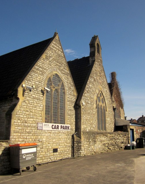
Image: © Derek Harper Taken: 15 Mar 2014
The former St Dunstan's Church, which was built in 1897 and remained operative until 1958. It seems to have originally served as a mission church to the nearby St Francis and St Aldhelm's. It is now St Dunstan's House, and used as business premises.
Images are licensed for reuse under creativecommons.org/licenses/by-sa/2.0
Image Location
Latitude
51.43272
Longitude
-2.610309