Bloomfield Road School
Introduction
The photograph on this page of Bloomfield Road School by Chris Martyn as part of the Geograph project.
The Geograph project started in 2005 with the aim of publishing, organising and preserving representative images for every square kilometre of Great Britain, Ireland and the Isle of Man.

There are currently over 7.5m images from over 14,400 individuals and you can help contribute to the project by visiting https://www.geograph.org.uk
Bloomfield Road School
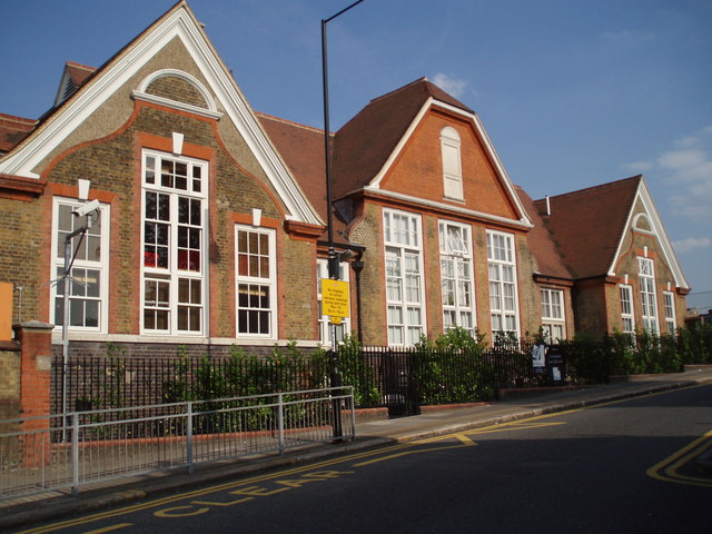
Image: © Chris Martyn Taken: 30 Jun 2006
This is the west elevation, showing the single-storey buildings facing Sandy Hill Road. The larger three-storey building (east side) faces Bloomfield Road itself. It is typical of dozens of Board School erected in London during the last quarter of the nineteenth century and the first decade of the twentieth century. Its use and status have changed many times over the years. For example in the 1950s it was a boys 'central school' (i.e. midway between a grammar and a secondary modern). In the 1930s, however, it was a mixed elementary school, with pupils aged 11-14.
Images are licensed for reuse under creativecommons.org/licenses/by-sa/2.0
Image Location
Latitude
51.482932
Longitude
0.070549